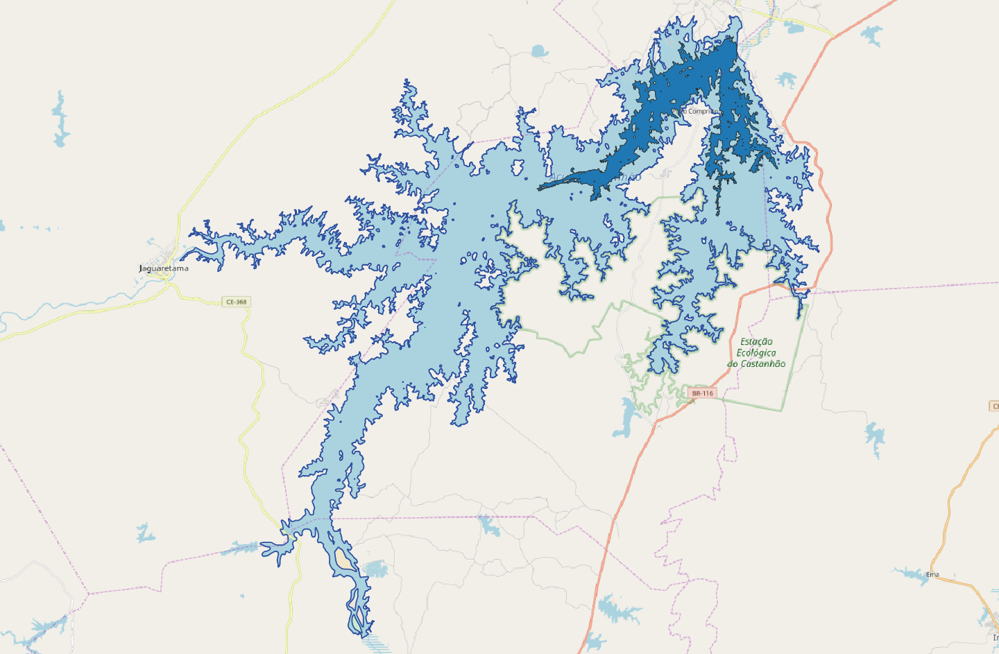
The lake formed by the Castanhão Dam in Brazil covered an original surface of 360 square kilometres. Since its opening in 2004, several drought events have taken place, which have reduced the lake surface of more than the 90%.
Below the thematic map for the lake Castanhão on the 09th May 2017. The original lake surface is represented in light blue, whereas the surface covered on the 09th May 2017 is represented in dark blue.
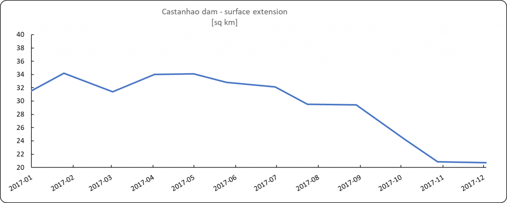
Below the chart of the historical trend of the surface of the lake Castanhão during 2017.

First released: 11/03/2019
Contains modified Copernicus Sentinel data [2017], processed by Melchionna – Remote Sensing
Categories
Favourite tools:


Interesting?

