The Eder reservoir, in Germany, was drastically affected by the long drought season experienced in Germany in 2018. With its nominal 11.8 km² reservoir, it has the 2nd largest area of all reservoirs in Germany. In November 2018, its area decreases to less than 3 km². In the figure above the thematic map for the Eder reservoir:
- on the 01st December 2017 – dark blue outline;
- on the 06th June 2018 – light blue outline;
- on the 02nd August 2018 – green outline;
- on the 01st October 2018 – filled blue.
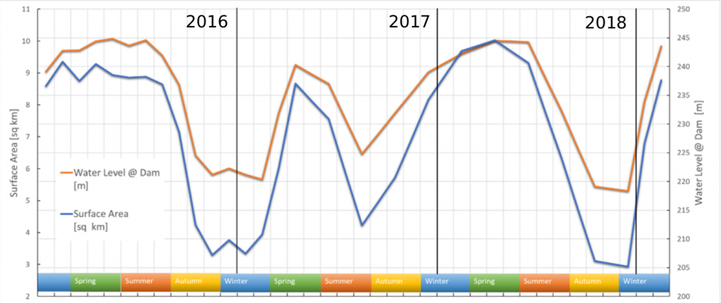
In the figure below the chart of the historical trend of the surface o the lake Edersee from 2016 to begininng of 2019.
First released: 11/03/2019
Contains modified Copernicus Sentinel data [2016,2017,2018,2019], processed by Melchionna – Remote Sensing
Categories
Favourite tools:

Interesting?